CHAOBAI RIVER (Chinese: 潮白河, cháobái hé), Beijing, China |
||
 |
||
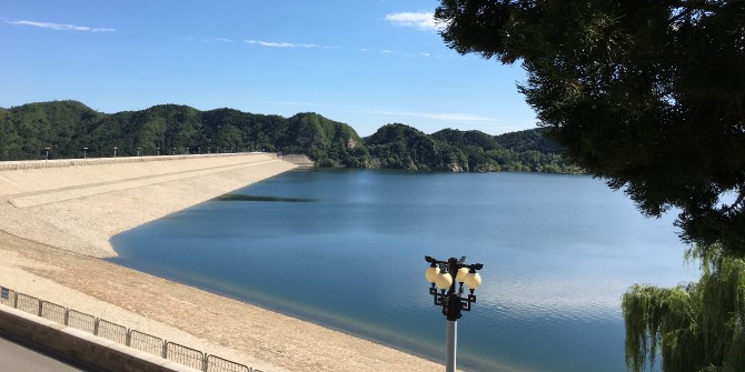
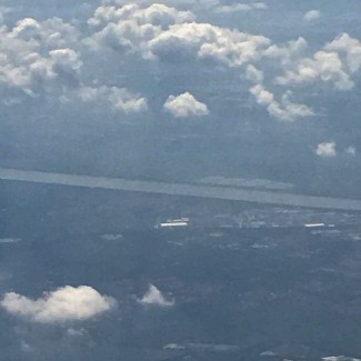
Miyun Reservoir. |
||
————————————————————————————————— This essay was originally posted to National Geographic's Water Currents blog on November 13, 2017. ————————————————————————————————— Special thanks to Dr. Fei Xue, University of Technology, Beijing, China; and Dr. Changwoo Ahn, George Mason University, and Principal Investigator for the panel, “EcoScience+Art: Interdisciplinary Collaboration Between Ecosystem Science and Art to Enhance Ecological Communication and Resilience,” at the International Association of Ecology, Beijing, China, 2017, funded by the National Science Foundation. —————————————————————————————————
I am the Chaobai River, created at the confluence of the Bai He (White River) and the Chao He (Tidal River), which feeds into the Miyun Reservoir, the city of Beijing’s largest source of potable water. It is a huge responsibility providing over 25 million people with enough hydration to survive! When released from the dam, my water flows for 59 miles (95 kilometers) into Beijing, the capital of China, initially through an open canal, and then part of me enters into iron and steel pipes, so that some of my liquid does not see daylight again until a person turns on the tap, and I emerge into a residential sink, bathtub, or toilet. Until 1981, I was also utilized for agriculture, but the government decided that my body would be better served if used only for domestic supply. My total length is about 280 miles (451 km), and I eventually make my way out to the Bohai Sea. |
||
 |
 |
|||
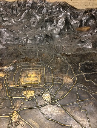
Bronze map of Beijing showing location of Miyun Reservoir in the upper right corner. This display is located at the Beijing Urban Planning Exhibition Hall. |
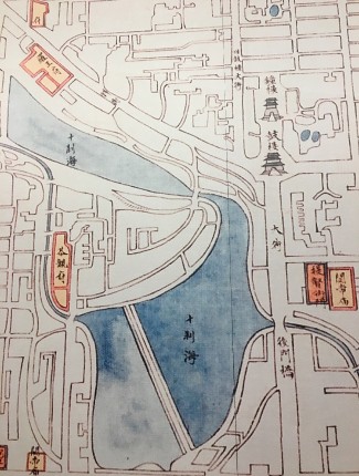
Old map showing Houhai and Qianhai Lakes. |
|||
Whereas I am used for potable water purposes, a separate cousin reservoir of mine, the Ming Tombs Reservoir, named for the Ming Tombs nearby, and also known as the Shisanling Reservoir, is used as a power station. The water is pumped from a lower reservoir up to a higher one, which then falls through four turbines. After the power is produced, the water discharges back to the lower reservoir and the cycle begins again. During the 2008 Beijing Summer Olympics, Triathlon events were held near this reservoir, and across the street from the dam there is still a huge concrete bas-relief mural dedicated to the three sports of Triathlon athletes.
The densely-populated city of Beijing is one of the most water-scarce in the world, and there have even been discussions about moving the capitol to another location nearer more reliable water sources. It has two rainy months, July and August, but the rest of the year it receives almost no precipitation. The annual average rainfall for New York City is 42 inches (1,067 millimeters) compared to Beijing that is only 22 inches (559 millimeters). Historically, this capitol received its water mainly from springs in the mountains, which flowed through canals into a system of lakes. However, in the past, deforestation to clear the land for development, began to dry up the springs, so many of them no longer flow, but that is beginning to change. Currently, groundwater from aquifers provide the majority percentage of the city’s water, but since abstraction is larger than replenishment, there has been a decline of the groundwater table, too. |
||
 |
 |
|||
Ming Tombs Reservoir. |
Canal bringing water to Beijing from Miyun Reservoir. |
|||
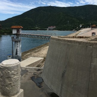
The construction of dams around the world displace people who have lived on the land for many generations. This was also true of the Miyun, which displaced over 200,000 people residing in numerous villages who had to be resettled. The families moved their possessions in horse-drawn carts to new locations. In 1963, my belly at the reservoir began to fill. The dam is 217 feet (66 meters) high with 302 steps to the top. |
||
 |
||
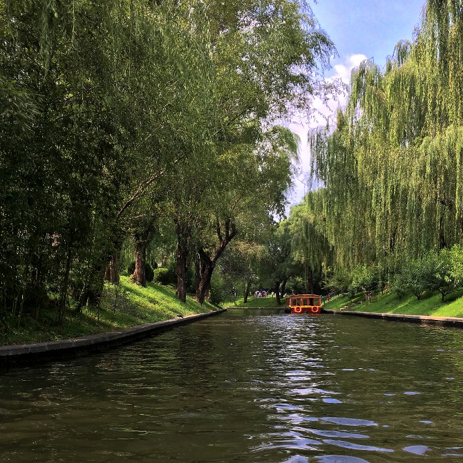
View from a boat on The Imperial Waterway. |
||
In the 1980’s, tourism began to take place all around the new reservoir, with hotels, restaurants, holiday resorts, and busloads of tourists flocking to be near me. But a few years later, due to pollution and security concerns, the entire perimeter was fenced so that no one could come for a swim or picnic, or even drive very near with a car. Fortunately, industries are prohibited from being located near my shores as a precaution against accidental pollution. Since the turn of the century, water reclamation has been aggressively pursued. Wastewater treatment plants throughout the city provide reclaimed water for non-potable uses, such as hydrating parks and roadside plantings. |
||
 |
 |
|||
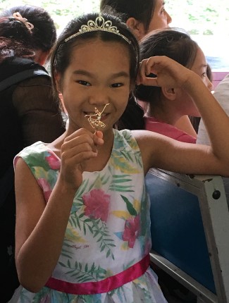
A girl, showing off her ballerina pin, enjoys the boat ride along the Imperial Waterway with her mother. |
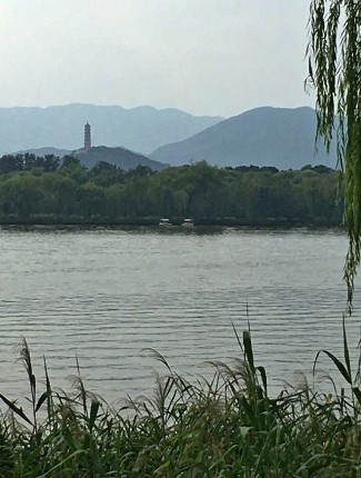
Kunming Lake looking toward Yu Feng Pagoda on Yu Quan Hill. |
|||
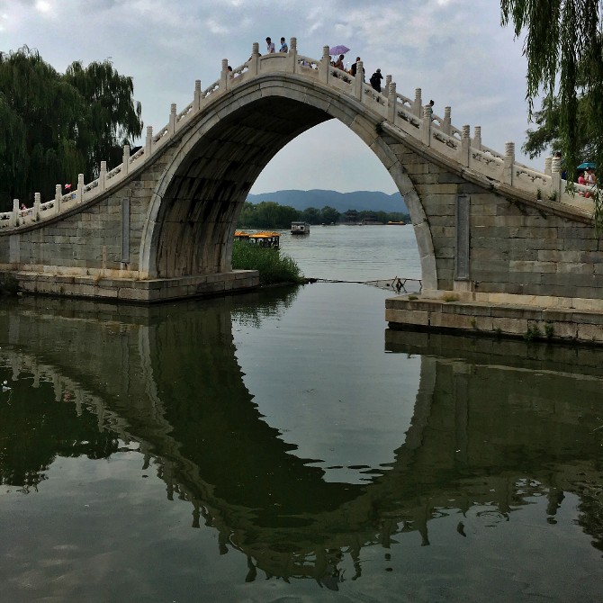
I feed a vast system of canals and moats, as do several of my river cousins. I provide water for the Beiyun River, which in turn provides flow for the Imperial Waterway, located in downtown Beijing. In ancient times this route was the preferred way of transport for royal families traveling to the Summer Palace that is home to one of the best-preserved Imperial gardens in China. In contemporary times, passengers on the boats will pass by the entrances to the zoo, aquarium, National Library of China, and the Purple Bamboo Park. The water in Kunming Lake of the Summer Palace Park flows all the way down from my reservoir up in the mountains. |
||
 |
||
Bridge at the Summer Palace framing Kunming Lake, fed by the Miyun reservoir. |
||
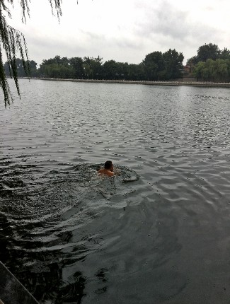
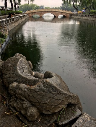
The Beiyun River is also fortunate to end up in a series of scenic lakes in this ancient city of Beijing. Qianhai Lake and Houhai Lake are part of an old water-supply route. Originally dug-out during the Fourteenth Century, the lakes were later expanded during the Ming dynasty as harbors for barges traveling into and out of Beijing on the Grand Canal. Most visitors to these lakes do not comprehend the adventurous journey that my waters have taken to get here from far away in the mountains. Both lakes provide a cooling retreat during the hot and muggy summertime, and even though there are “no-swimming” signs posted, it does not stop intrepid athletes. In winter, my lake waters freeze, so that visitors can ice skate, play hockey, and walk across the ice. |
||
 |
 |
|||
Even on a chilly, rainy day, with “no swimming” signs posted, swimmers enter the refreshing waters of Lake Qianhai. |
A resting dragon who is said to calm the waters, guards Houhai Lake. |
|||
Most major cities in the world have a river, which helps to define them. Paris has the Seine, London has the Thames, and Seoul has the Han. Beijing used to have as many as 200 rivers; today very little remains natural about any of my water, as I have been artificially channelized, and managed through elaborate urban planning. Several bits and pieces of me -- an arm here, a leg there -- used to flow through Beijing, including the Yongding River, which is now drier due to over-use, and development. The Beijing Municipality government invested large sums of yuan (Chinese currency) in an effort to replace several riverbeds with parkland. 1.7-mile-long (2.8 kilometers) Huangchenggen Park is built on top of what used to be part of my body, so now what remains of me is buried underground. Without even knowing that I am here, visitors to the park enjoy a seven-month calendar of flowers including crape myrtle, Chinese rose, forsythia, magnolia, winter jasmine, and flowering crabapple.
In 2013, Chinese President Xi Jinping announced that cities should act “like sponges.” This was an idea that came with substantial funding to experiment with ways cities could mitigate floods by absorbing precipitation with rain gardens, “green roofs,” increased tree cover, constructed wetlands, and permeable pavements, to help slow down, capture, and filter storm water that could replenish aquifers or be stored. Sponge cities provided a new term for urban designers throughout the world. The traditional approach in a town is to cover the land with impermeable roads, sidewalks, and buildings that interfere with the hydrologic cycle, but sponge cities mimic the natural water cycle. Beijing has plans to develop 70 new green spaces to collect excess storm water, which will help during the rainy season, and recharge the aquifer.
Two of China’s sponge cities have already reaped benefits: Wuhan invested heavily in experimental green projects with the result that they managed the heavy storms in 2016, and the coastal city of Xiamen endured Typhoon Nepartak without becoming waterlogged. Traditional infrastructure (gray infrastructure) composed of pumps, drains, concrete channels, and pipes, is often used for a single purpose, whereas green infrastructure offers an array of economic, environmental, and social benefits. Cities will need to be retrofitted, which will not be easy or cheap, but it is beginning to look like it is worth the effort. For example, some mountain springs have come back in the west of Beijing. These experiments in green city planning might help ease the stress put on my water in the Miyun Reservoir. And who knows, perhaps the natural ways of flowing water will be restored to a place of reverence and understanding. |
||
next page: Saskatchewan River Delta >
< previous page: Merced River